The mill at Pactolus
Pactolus · Carter County, Kentucky
Follow the connection between a river, a mill, and the grain people needed to grind.
Picture the working place.
Read each picture like a page from an old schoolbook. Match the numbered labels with the notes below, then compare the scene with the photographs and records.
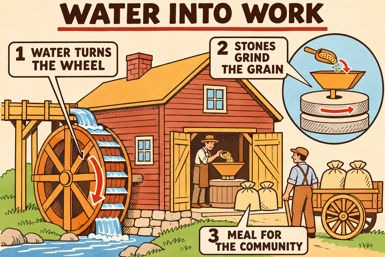
A water-powered gristmill
Water turns the wheel, and millstones grind grain into meal or flour. The inset explains a general milling arrangement. This representative scene is not a reconstruction of Pactolus Mill or its machinery.
Open full illustrationLook for
- Water turns the wheel. Follow the water to the wheel that supplies motion for the mill.
- Stones grind the grain. Use the inset to picture grain passing between the millstones.
- Meal for the community. Imagine sacks of ground grain returning to homes.
Modern AI-generated educational illustration. Created by the Restoring What Was Lost History Workshop.
Historical reference: California State Parks: how Bale Grist Mill works
See the place.
Read the date and caption with each image. Historical photographs and modern aerial views show different parts of the story.
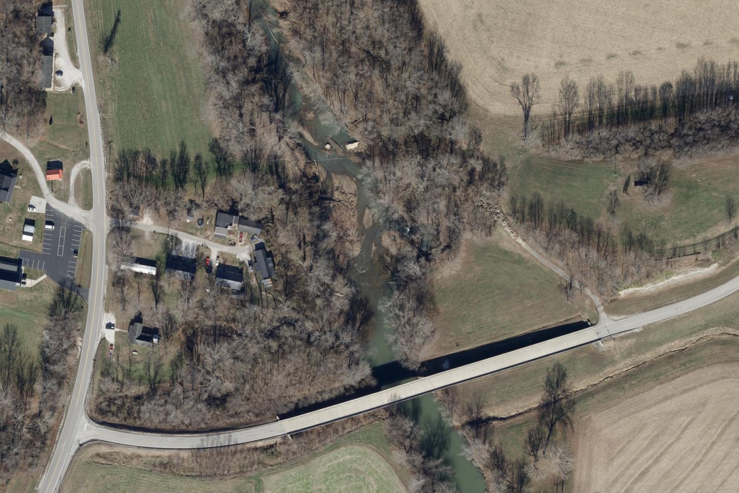
The Little Sandy at Pactolus, with the bridge across the lower part of the photograph. Our field inventory records the old dam north of the present bridge. This modern view does not identify the former mill building.
KyFromAbove, Kentucky Division of Geographic Information. Imagery source ↗ · CC0 imageryFind the place.
Start with the dam and bridge recorded by our river project. Switch to aerial photographs to compare the channel, roads, and riverbanks. The dam pin is a field record; the mill’s exact building location remains a research question.
Loading the location map…
Pactolus dam · field record
The old dam location recorded in our river field inventory and reviewed by the project owner in Google Earth. The original mill building’s footprint has not been established. Coordinate accuracy was not recorded.
Our Pactolus dam field record ↗Pins identify the place described in each label. A historical marker or community pin may be separate from the original building. These are research locations, not confirmed visitor entrances.
Start with the record.
A 1942 newspaper account describes a dam and a water-powered mill still operating at Pactolus on the Little Sandy River. This gives us a dated glimpse of the mill at work. The learning diagram explores how water can drive milling machinery; it does not claim to show the actual arrangement inside Pactolus Mill.
Based on 1942 newspaper account of Pactolus (archived transcription); California State Parks: Bale Grist Mill (PDF).
A few moments in the story.
- About 1810
A mill on the river
Francis Nash’s local history places the mill’s beginning around 1810. Treat that as an approximate date.
Historical Views of Carter County, p. 13 ↗ - 1899
A bridge connects the banks
The local bridge archive describes a Lafayette Bridge Company crossing completed in 1899, linking people east of the river with the village and railroad.
Pactolus bridge archive ↗ - 1942
The watermill is still at work
H. Rupert Wilhoit described the mill making meal and an older log dam that had been replaced with concrete.
The Sandy Valley Enquirer, December 10, 1942 ↗
How could moving water help turn grain into food?
Use this explanatory drawing to investigate the idea. Choose an observation below the picture.
Choose a way to look closer
Follow the water
Start at the river in the diagram. Trace the route to the wheel with your finger.
In this general example, moving water turns a wheel. The water supplies motion, not the grain being ground.
Notice. Sketch. Ask a better question.
Choose one prompt for a family conversation, or use all three as a classroom investigation.
Draw two different paths: one for water and one for grain. Where does each begin and end?
What might a miller need to change when the river is very low or very high? Frame your answer as a question to investigate.
List two kinds of evidence that could show how the actual Pactolus Mill worked: a photograph, a map, a machine part, or an account from someone who knew it.
The lesson PDF pairs teaching notes with learner pages. Allow around 45 minutes for discussion and the activity, adapting the pace to your group. Model building, when chosen, takes additional time.
Download lesson: Pactolus Mill: water into workRead the sources.
Compare what a source says with what the diagram shows. Record uncertainties instead of filling them with guesses.
- 1942 newspaper account of Pactolus (archived transcription)
Contemporary account of a dam and a mill still operating at Pactolus.
- California State Parks: Bale Grist Mill (PDF)
A documented gristmill example for water power and milling mechanics, not evidence of Pactolus’s exact machinery.
Help fill in the picture.
A family photograph, an old plant map, or a memory with a name and date can help us understand this place more clearly. Tell us what you know and where the information came from.
Share a history lead →Keep the connections going.
Created by the Restoring What Was Lost History Workshop.